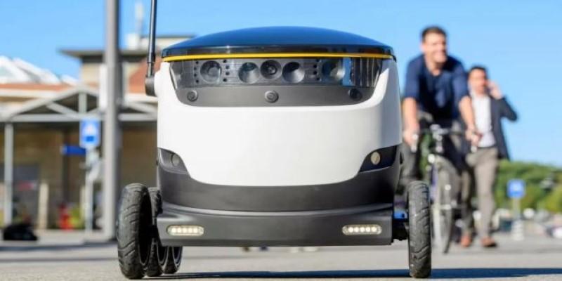
The final stretch of package delivery, the "last mile," presents a significant hurdle for automation. Standard Global Positioning System (GPS) reliably guides autonomous vehicles to a street address, but it cannot navigate the complex, unmapped private property to locate the exact front door. Door placement is highly variable, often obscured by landscaping, stairs, or vehicles. Mapping every property with centimeter accuracy is too costly and quickly outdated.
This gap—the critical journey from the street curb to the precise drop-off point—is what separates a successful delivery robot from one that requires human intervention. MIT researchers are addressing this challenge by teaching robots semantic context, moving beyond fixed coordinates to understand a home environment.
The Semantic Navigation Breakthrough
MIT's core innovation is semantic navigation, which enables a robot to locate its destination based on its conceptual meaning, such as "front door," rather than geometric coordinates. This approach mirrors how humans navigate. A human seeking a front door instinctively understands that driveways and sidewalks typically lead to an entrance and recognizes the typical architecture surrounding a main door. The AI model developed by the researchers replicates this contextual reasoning. It eliminates the need for expensive, detailed 3D maps of every single property, which greatly enhances scalability for deployment across new areas. The goal is to allow a robot to be placed in an unfamiliar neighborhood and still determine the most intelligent path to the delivery spot.
The system utilizes a convolutional neural network (CNN) to process visual sensor data into a semantic map. The robot’s camera input is analyzed in real time to apply specific labels to objects in its field of view, identifying them as "driveway," "sidewalk," "hedge," or "front door." This initial process is a type of real-time object recognition and segmentation. The model was trained using annotated aerial satellite images of residential and commercial properties. Using satellite imagery allowed the model to learn the predictable layout and general arrangement of these features relative to the main building structure and property boundaries.
The Cost-to-Go Estimator and Path Planning
Generating the semantic map is just the first step; the robot must then find the optimal route. This is handled by the "cost-to-go estimator" algorithm, a deep learning component. It transforms the semantic map into a dynamic cost map, which functions as a real-time heat map to guide the robot's movement.
Within this cost map, different environmental features are assigned a "cost" value reflecting the difficulty or undesirability of moving through them toward the goal. Areas far from the front door have a higher cost, while locations closer to the entry point have a progressively lower cost. For instance, a lawn or a neighbor’s property would have a higher cost than a clear driveway. The front door is the lowest cost point. This system translates the conceptual goal, "find the front door," into a concrete, mathematical problem: follow the path of the steepest descent toward the minimal cost point.
The model was trained on the labeled satellite data, but critically, it incorporated simulated partial views. The researchers applied virtual masks to the images to simulate the limited field of view and occlusions a small, ground-based robot would experience, such as its view being temporarily blocked by a parked vehicle or a dense bush. Training with these partial views helps the system manage the uncertainty and limited information encountered in real-world, dynamic environments, allowing the robot to make efficient path decisions even when the final destination is not entirely visible.
Data Challenges and Deployment Realities
While the system is technically sound, practical deployment introduces significant constraints, particularly related to data bias and inference latency. The training data primarily featured architecture common in specific American suburbs. This introduces a bias that may cause model drift when deployed in regions with highly different visual characteristics, like densely packed European cities or multi-story apartment buildings with internal, secure courtyards. A model trained on front porches will struggle with an unmarked entry door flush with a brick wall.

Speed is also a paramount concern. For a delivery robot to be practical, the AI inference process—the time taken to capture a frame, process it through the CNN for semantic labeling, generate the cost map, and calculate the next movement—must have minimal latency. Slow processing leads to hesitant, jerky movement, undermining the efficiency gains of automation. The system must be highly optimized to run on the robot's constrained, low-power onboard processors, balancing the demand for high accuracy with the need for low inference cost and battery efficiency.
Future Trajectory and System Limitations
This semantic navigation method offers a proven boost in performance, allowing robots to find a door significantly faster than methods relying purely on geometric mapping. Its core concept is highly versatile and could be retrained to identify other goals, such as a "loading dock" or a "side gate."
However, the system has inherent limitations. It is excellent at identifying the location of the goal but does not solve the complex control problems required for interaction, such as ringing a doorbell or manipulating a package drop-off mechanism. Furthermore, it is not a complete solution for dynamic obstacle avoidance; the robot still needs robust, lower-level control systems to handle unexpected events like a person or pet suddenly crossing its path.
The system’s reliance on visual data also means its performance can degrade significantly under challenging weather or lighting conditions, such as heavy rain, fog, or deep shadows, which can corrupt the initial semantic labeling. A viable commercial solution will necessitate combining this semantic guidance layer with other sensor modalities, like LiDAR and radar, to ensure reliable performance across all environments.
Conclusion
MIT's deep learning model advances last-mile delivery by teaching robots semantic navigation, interpreting cues like driveways to find doors. This highly scalable system creates a dynamic, cost-to-go map, replicating human intuition without expensive pre-mapping, boosting efficiency. Future efforts must focus on mitigating data bias and achieving low-latency, power-efficient inference. Successful deployment requires integrating this powerful AI with complementary sensors for robust, all-weather performance.